Val Torreggio: loop between Lago di Zana and Lago di Arcoglio
Route from Torre di Santa Maria to Sasso Bianco, passing through alpine pastures, woods, meadows, and high-altitude views
Length: about 14 km
Total elevation gain: about 800 m
Duration: about 6 hours and 30 minutes
Difficulty: E (hiking), with some unclear paths and no fixed route
You can explore Val Torreggio with a loop route. It takes you to Lago di Zana, Sasso Bianco, and Lago di Arcoglio, starting from Torre di Santa Maria. The trail first climbs to the Arcoglio pastures, enters Val Torreggio, and reaches Lago di Zana at 2,280 meters. From there, it continues to the Sasso Bianco summit at 2,490 meters, then descends to Lago di Arcoglio and returns along the Alta Via della Valmalenco.
The terrain is varied. You'll find dirt roads, forest paths, and pastures. In some places, there's no fixed path, so follow trail markers.
Route to Lago di Zana, Sasso Bianco, and Lago di Arcoglio
From Torre di Santa Maria, follow signs for alpine huts. Drive up the road to the Arcoglio-Piasci junction, where you can park with a transit permit. You can leave your car at Musci, around 1,000 meters high, at the fourth left turn after San Giuseppe. From there, a path climbs through the woods to Pra' Fedugno and meets the track near the parking area.
At the Arcoglio-Piasci junction, take the left track to Alpe di Arcoglio Inferiore, at 1,976 meters. Once out of the woods and seeing the first huts, follow the trail up the meadows to Alpe di Arcoglio Superiore, at 2,123 meters, where there's a small isolated church.
Here, leave the Alta Via della Valmalenco and follow the white-red markers towards Rifugio Bosio. The path crosses scree, dwarf pines, and larches, reaching a ridge at about 2,150 meters, overlooking Val Torreggio, marked by a wooden cross.
From here, the path gradually descends. It crosses a slippery rocky area and a landslide zone. Then it enters among larches and mountain pines again. Continuing, you reach the wide plateau of Alpe Zana, at 2,089 meters.
To reach Lago di Zana, you climb through the wooded slope. You go up to a higher basin with some ruins. Then you continue through a gully until you reach a plateau at 2,280 meters. From here, you proceed on open terrain with a faint trail, using the few markers along the way.
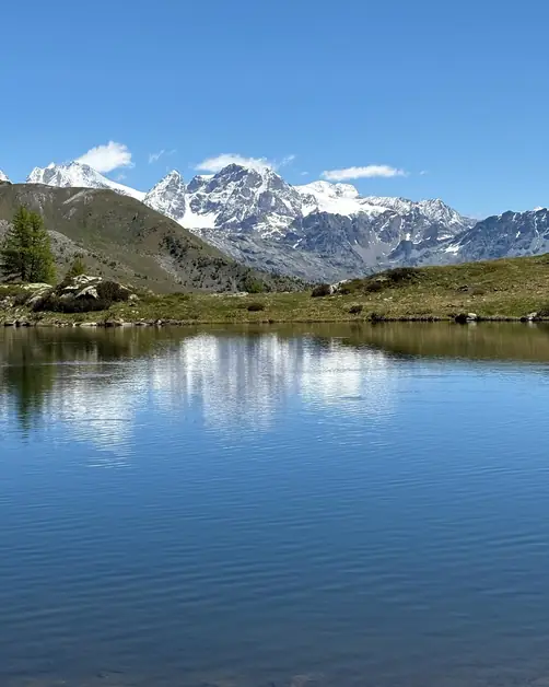
You then reach a natural balcony. Below, you see Lago di Zana, at 2,280 meters. A trail allows you to easily descend to its eastern shore. Unlike popular alpine spots like Lago di Braies, Lago di Zana remains a hidden, quiet gem. It's accessible only via less-traveled paths in Val Torreggio.
To continue the loop, return to the balcony. Then ascend without a set path toward the ridge closing Val Torreggio. The light-colored rocks of Sasso Bianco gradually become visible. A trail leads to the summit of Sasso Bianco, at 2,490 meters.
From the summit, descend the southern slope, initially steep. The path crosses a basin and a landslide area. It then reaches the western shore of Lago di Arcoglio.
Here, you find the marked trail of the Alta Via della Valmalenco, which you follow back. The path passes on the left of the lake and descends to the basin of Alpe di Arcoglio Superiore.
From this point, the path matches the one taken earlier. You pass near the small church and descend to Alpe di Arcoglio Inferiore. Finally, follow the dirt track back to the Arcoglio-Piasci junction and the starting point.
If you're looking for other hikes in Valmalenco, consider the loop to Rifugio Longoni, starting from Alpe Entova. To plan a few days in the valley, check out my guide to Chiesa in Valmalenco. It's useful as a starting point for various activities. If you have mountaineering experience and want to go higher, I also wrote about staying at Rifugio Marco e Rosa, at about 3,600 meters in the Bernina group.