Longoni Refuge: circular hike from Alpe Entova
From Chiareggio to an altitude of 2,450 meters, through woods, rocky areas, and views of Monte Disgrazia, returning via the Piana di Fora
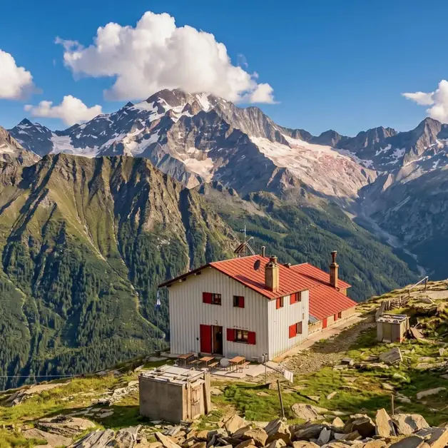
The Rifugio Longoni is at 2,450 meters in Alta Valmalenco, on a rocky balcony facing Monte Disgrazia. You can reach it from Chiareggio with a 13 km loop and 900 meters of elevation gain. The route passes Alpe Entova and, on the way back, crosses Piana di Fora and Alpe Fora.
The first part of the climb goes through larch and pine forests, with Val Sissone, Cime di Rosso, and Monte Sissone in the background. After Alpe Entova, the path gets steeper until the rocky area before the refuge. From there, you can see Monte Disgrazia and the surrounding peaks. The return completes the loop through a glacial basin and Lago del Ciàz.
From Chiareggio to Rifugio Longoni via Alpe Entova
The journey starts from Chiareggio, at 1,612 meters. The trail initially winds through a larch-pine forest, with views of Val Sissone behind you.
The slope gradually eases until you reach Alpe Entova, at 1,917 meters, known for its renovated huts. Nearby is the small lake of the same name.
After the alpe, the path becomes steeper again. The final part of the climb crosses a rocky section and leads to the panoramic terrace where Rifugio Longoni stands, reaching the itinerary's highest point, 2,450 meters.
From the refuge, Monte Disgrazia dominates the view. You can see peaks enclosing the valley, like Sassa d'Entova, Pizzo Tremoggia, and Sassa di Fora. Lower down, the view follows the valley towards San Giuseppe.
If you want to stay overnight, half board costs between 60 and 75 € per person. For just sleeping, a dorm with more than four beds costs about 34.50 € full price. A room with up to four beds costs around 39 €. CAI members get discounts.
Staying overnight isn't the only reason to stop at the refuge: it's also worth it for the food. We enjoyed excellent and plentiful pizzoccheri and tagliatelle with venison ragù, plus a delicious cake. I especially recommend the walnut cake!
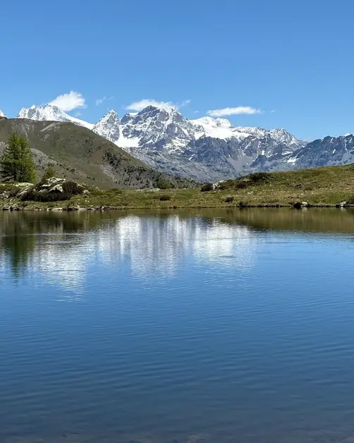
The return doesn't follow the same path. Instead, it completes the loop by passing through Piana di Fora, in the glacial basin with a lake, collecting waters from waterfalls.
From here, you reach Alpe Fora, at 2,053 meters, before heading back into the woods. The descent continues to Chiareggio, where the loop ends.
If you want to discover more routes in Valmalenco, try the Val Torreggio loop. It leads to Lago di Zana and Lago di Arcoglio. For a longer stay, start with my guide to Chiesa in Valmalenco. Experienced climbers seeking a different environment can read about Rifugio Marco e Rosa, around 3,600 meters in the Bernina group.