Rutor Waterfalls the ultimate guide for a unique hike
Discover the ultimate guide to visiting the Rutor waterfalls.
Where are the Rutor waterfalls located?
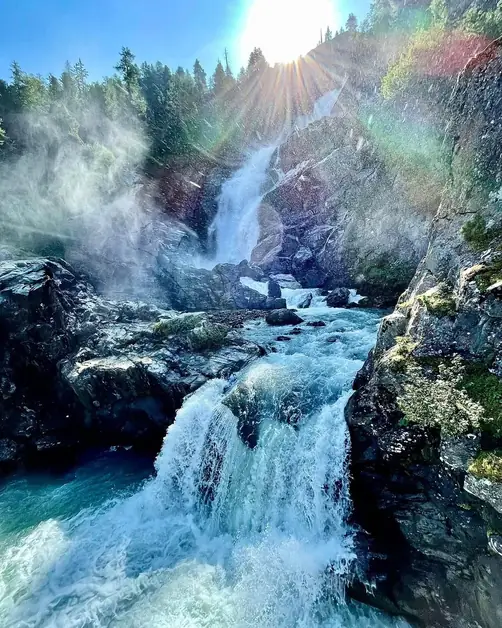
The Rutor waterfalls are located in the territory of La Thuile, in the Aosta Valley, within a natural frame dominated by the Rutor glacier. They are three impressive waterfalls that descend from different altitudes: the first at 2,030 meters, the second at 1,850 meters, and the third at 1,700 meters. This series of waterfalls originates from the glacier itself and feeds the Dora del Rutor stream, creating a powerful landscape made of gorges and precipices.
How to reach the Rutor waterfalls from La Thuile?
The most commonly used starting point is La Joux, a small hamlet a few kilometers from La Thuile. From here, a well-marked trail leads to the waterfalls, taking about 45 minutes of walking to reach the first one. To get to La Joux, you can use a car: from the center of La Thuile, the road is paved and easy to navigate. Those without a car can use public transport: during the summer months, a shuttle service operates from La Thuile to La Joux, specifically designed to facilitate access to the hike.
Where to park near the Rutor waterfalls?
At La Joux, there is a small parking area available. During peak season, especially on summer weekends, it tends to fill up quickly. If there is no space, you can leave your car in La Thuile and reach La Joux by shuttle or on foot along a stretch of road. It is advisable to arrive early in the morning to avoid not finding parking.
What hiking trails lead to the Rutor waterfalls?
The classic route starts from the La Joux parking lot and crosses ancient mule tracks and centuries-old coniferous forests. The first waterfall is reached after about 45 minutes of walking. Continuing, you encounter the second waterfall, more spectacular and framed by rocky walls. The third drop is admired thanks to the iron bridge built in 2014, which allows you to cross the watercourse right in front of the waterfall. Here, the scenery becomes unforgettable: the water crashes against the rocks and vaporizes in the air, creating a fresh cloud that moistens the skin.
How long does it take to visit the Rutor waterfalls?
The time required depends on how many waterfalls you wish to reach. To get to just the first one takes about 45 minutes of walking. To see all three waterfalls takes about two hours, considering stops and photographs. The trail is well-maintained and does not present particular technical difficulties, although in some sections the ascent can be steep.
What does it feel like during the hike to the Rutor waterfalls?
The experience is all-encompassing. The constant sound of water accompanies every step, increasing as you get closer. In the closest spots to the falls, the power of the stream transforms into a light mist that wets your clothes and refreshes your body. Walking through the woods, crossing bridges, and stopping to observe the water games offers a complete immersion in the alpine nature. It is one of the places where the strength of the mountain manifests itself in all its energy.
When to visit the Rutor waterfalls?
The best time is from June to September. During these months, the trails are clear of snow, and the water flows strongly due to the melting of the glacier. Early summer has a greater flow, while at the end of the season, the clearer days offer sharp views of the surrounding peaks.
Are there shelters or refreshment points near the Rutor waterfalls?
Near the waterfalls, there are no proper shelters. However, starting from La Thuile, it is possible to find restaurants and bars to stop at before or after the hike. Many tourists choose to bring a packed lunch and consume it along the trail, taking advantage of the flat areas near the woods.
What to bring for the hike to the Rutor waterfalls?
It is advisable to wear trekking shoes with good grip, as the sections near the waterfalls can be slippery. Bringing a light jacket or a sweatshirt is also useful in summer, as altitude and humidity lower the temperature. Water is essential, even though the trail is bordered by streams and torrents.
