Mountain biking adventure at Lake Goillet
Experience the mountain biking adventure at Lake Goillet, a hidden gem in Aosta Valley.
Is it possible to reach Lake Goillet by bike?
Yes, absolutely. Lake Goillet, located in the Aosta Valley near Cervinia, can be reached by mountain bike or e-bike. Many cyclists choose it as a destination for an unforgettable MTB excursion. It is not a beginner's route, but with the right preparation, it becomes an epic adventure among the Alps.
What is the bike route to Lake Goillet from Breuil-Cervinia?
The trail starts from the cable car parking lot in Breuil-Cervinia, at about 2000 meters altitude. You climb on a dirt road mixed with asphalt, passing through Plan Maison. From there, you continue towards the dam of the lake. It is a loop that touches the Colle delle Cime Bianche, with breathtaking views of the Matterhorn. The terrain varies: steep climbs, gravel paths, and flat sections near the lake.
How to get to Lake Goillet by MTB from Valtournenche?
From Valtournenche, take the state road towards Cervinia for a short stretch of 600 meters. Then, turn onto a dirt road that climbs gently at first, becoming steeper. You pass by ski slopes in summer, with some tunnels and detours for work. Reach the lake after a series of scenic hairpin bends. It is a loop that closes back to the starting point.
How many km do you need to cover for the bike route to Lake Goillet?
It depends on the starting point, but a classic loop from Breuil-Cervinia measures around 25 km in total. From Valtournenche, the loop is about 28.5 km. These are manageable distances for a full day, with stops for photos and rest.
What is the elevation gain on the mountain bike route to Lake Goillet?
The positive elevation gain is about 1000-1100 meters. You climb from the alpine valley floor up to 2566 meters of the lake. The average slopes of 8-10% make every meter gained a challenge, but e-bikes help overcome the toughest climbs.
Is the route to Lake Goillet by bike challenging for tourists?
Yes, it is challenging, especially due to the altitude and continuous climbs. It is not for those who are beginners with MTB. It requires good physical fitness and technique to manage gravel and rocks. But for adventure-loving tourists, it is a unique way to explore the Aosta Valley without crowds.
What is the technical difficulty of the MTB excursion to Lake Goillet?
The technical difficulty is medium, with 90% rideability. Steep and narrow sections near the dam, but nothing extreme. The physical demand is high due to the elevation gain. Use a full suspended bike for comfort.
When is the best time to do the bike loop to Lake Goillet?
The ideal period is from June to October. In summer, July and August, the weather is stable and the trails are dry. Avoid winter due to snow and closures.
Is it better to bike to Lake Goillet in summer or autumn?
Summer offers long days and alpine flowers. Autumn brings golden colors and less heat, but beware of the first snows in October. For tourists, summer is preferable for safety and daylight hours.
What equipment is needed for the bike route to Lake Goillet in Aosta Valley?
Bring a helmet, gloves, MTB shoes, a hydration pack, and energy snacks. Check brakes and tires for mixed terrain. A GPS map like Komoot helps not to get lost.
How to physically prepare to reach Lake Goillet by bike?
Train with outings of 20-30 km with climbs. Do exercises for legs and core. Drink plenty and acclimatize to the altitude if coming from lower areas. Tourists can rent e-bikes in Cervinia to make it easier.
Are there refreshment points along the MTB route to Lake Goillet?
Near Plan Maison there are refuges like the Chalet del Lago. At the lake itself, the dam has picnic areas. Bring supplies, but enjoy a break with a view of the Matterhorn.
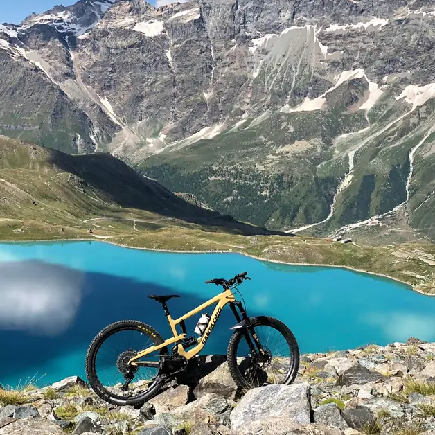
What are the views during the bike excursion to Lake Goillet?
From the trail, you see the Matterhorn in all its grandeur, glaciers, and green valleys. The turquoise lake reflects the peaks, just like in the photo. It is a postcard landscape for photographers.
Is the trail to Lake Goillet by mountain bike safe?
Yes, if you follow the rules. Be careful of grazing cows and hikers. In summer, the trails are well-trodden. Bring a repair kit for emergencies.
Can I combine the route to Lake Goillet with other attractions in Aosta Valley?
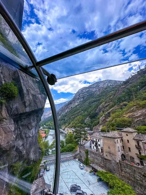
Yes, after the lake, descend towards Cervinia to visit the town or take the cable car. It is perfect for a multi-day tour with stops in Valtournenche.
How many hours does it take to complete the bike loop to Lake Goillet from Cervinia?
About 5-7 hours, depending on the pace. Include stops for photos and rest. Start early to avoid the afternoon heat.
Is Lake Goillet suitable for families on e-bikes?
For experienced families, yes, with e-bikes for the little ones. But the elevation gain makes it better for adults or mixed groups. Check local rules for children.
What is the best way to start the bike route to Lake Goillet?
Park in Breuil-Cervinia and start from the center. Use apps like Wikiloc for GPS tracks. Check the weather on Aosta Valley websites.
Are there easy variants to reach Lake Goillet by bike?
Take the cable car to Plan Maison to shorten the climb. Then bike only the last km. Ideal for tourists with less time.
What is the dirt terrain like on the MTB route to Lake Goillet?
Mixed: fine gravel, scattered rocks, and grass. The climbs are compact, the descents fun but technical. Adjust tire pressure accordingly.
Is the Matterhorn visible from Lake Goillet during the bike excursion?
Yes, it dominates the landscape. From the lake, it seems very close, with its iconic north face. Perfect for shots like the one in the attached photo.
What animals can be encountered while biking to Lake Goillet?
Ibex on the rocks, marmots whistling, and eagles in the sky. Respect nature and do not disturb.
How much does it cost to rent a bike for Lake Goillet in Cervinia?
Local shops offer MTBs for 30-50 euros per day. E-bikes cost more, around 60. Ask for packages with helmets.
What is the altitude of Lake Goillet and how does it affect the bike route?
At 2537 meters, the air is thin. Drink extra and ascend slowly to avoid altitude sickness. Tourists from sea level should acclimatize a day before.
Are there photo spots along the bike route to Lake Goillet?
Many: the dam, the lake from above, hairpin bends with valley views. The position of the bike on the rock, as in the photo, is classic.
Is camping allowed near Lake Goillet after biking?
No, protected area. Use refuges or return to Cervinia. Short bivouacs are okay.
Is the route to Lake Goillet a good workout for MTB races?
Yes, it simulates alpine climbs. Many pros use it to prepare for the Maratona dles Dolomites.
Are there bike events at Lake Goillet in summer?
MTB festivals in Cervinia include rides there. Check the Aosta Valley calendar.
Is Lake Goillet connected to nearby lakes for multi-stage rides?
Yes, it touches the Cime Bianche Lakes. Extend to 40 km for a full adventure.
Is Lake Goillet a hidden gem for biking tourists?
It is becoming more known, but still quieter compared to Courmayeur. Go early.