Explore the incredible fortifications of Plan Puitz
Discover the fortifications of Plan Puitz in Aosta Valley, a historical hike not to be missed.
Where are the fortifications of Plan Puitz located?
The fortifications of Plan Puitz are located in the Aosta Valley, above the municipalities of Saint-Rhémy-en-Bosses and Saint-Oyen, at about 2090 meters above sea level. This military structure was carved into the rock during World War I, never completed, but today it is visitable as a historical testimony immersed in the alpine nature.
How to reach the fortifications of Plan Puitz by car?
If you are traveling by car from Aosta, take the SS27 of the Gran San Bernardo until you reach Saint-Oyen or Saint-Rhémy-en-Bosses. From both villages, marked trails lead up to the fortifications. Parking is limited: in Saint-Oyen you can leave your car in the town center or near the church; in Saint-Rhémy there are small spaces before the village. During summer weekends, parking spots may be limited: it is advisable to arrive early in the morning to find a spot.
Can you reach Plan Puitz by public transport?
Buses from Aosta run to the Gran San Bernardo, stopping at both Saint-Oyen and Saint-Rhémy-en-Bosses. Once you get off at the stop, you need to continue on foot: from Saint-Oyen, the ascent takes about 2 hours and 30 minutes, while from Saint-Rhémy it takes about 2 hours. Bus schedules change between summer and winter, so it is good to check them before departure.
What trails lead to the fortifications of Plan Puitz?
Trail from Saint-Oyen (signpost 14): starts from the town center (altitude 1389 m) and steadily climbs to 2097 m. Trail from Saint-Rhémy-en-Bosses: follows a section of the Alta Via 1 and crosses panoramic woods and pastures. Trail from Eternod Dessus: here you take the old military road built for the fortress works, with a gentle slope and wide views of the valley.
How long does the hike to the fortifications of Plan Puitz take?
The average ascent time is between 2 and 3 hours depending on the starting point. The hike is classified as hiking level (E): it does not present technical passages but requires appropriate clothing and hiking shoes. The elevation gain varies from 400 to 700 meters depending on the chosen itinerary.
What can you see when visiting Plan Puitz?
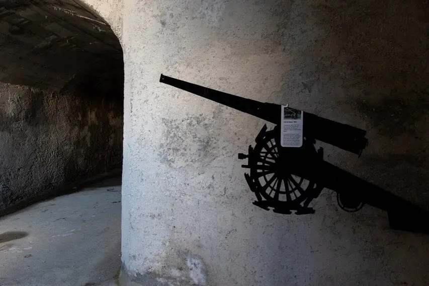
Inside the mountain, there are galleries, shooting rooms with loopholes, and a long corridor leading to the observation well, from which you can admire the Gran San Bernardo valley. Some parts have been made safe and equipped with informative panels and photovoltaic lights. The environment remains evocative and rich in charm, with walls carved into the rock and traces of military life from 1916.
Is it possible to enter the fortifications of Plan Puitz freely?
Yes, entry is free and no ticket is required. Inside, there are signs warning to be cautious, as some areas are not fully restored. It is advisable to bring a flashlight or headlamp, as some galleries remain dimly lit. The temperature inside is lower than outside, so a light jacket may be useful even in summer.
What is the best time to visit Plan Puitz?
The hike is recommended from May to October for walkers, while in winter it is accessible with snowshoes or ski mountaineering. In summer, the ascent offers green panoramas and blooming pastures, while in autumn the woods turn yellow and red. In winter, with abundant snow, the area becomes very picturesque but requires more preparation.
Can you reach Plan Puitz by mountain bike or e-bike?
Yes, several local operators organize guided tours in mountain bikes or e-bikes. The itinerary usually starts from Etroubles, crossing ancient irrigation channels and alpine pastures, until reaching the fortifications. It is a suitable solution for those who want to combine sport and history, with the assistance of a guide.
What views can be admired from the fortifications of Plan Puitz?
From the natural balcony above the fortifications, you can see the village of Saint-Oyen, the peaks surrounding the Gran San Bernardo Pass, the meadows and forests covering the slopes of the valley. On clear days, the view opens up to wide portions of the central Aosta Valley.
Are there other points of interest near Plan Puitz?
Nearby, there are several places that can enrich your day: Etroubles, a blooming village with stone houses and cobbled streets. Gran San Bernardo Pass, with the ancient hospice and the San Bernardo dog museum. Saint-Rhémy-en-Bosses, known for its DOP raw ham aged at high altitude. An itinerary that combines nature, history, and local flavors.