Complete Guide to Lake Goillet and Matterhorn
Explore Lake Goillet and Matterhorn for an unforgettable hiking experience.
Where is Lake Goillet located? Position and location
Lake Goillet is located above Breuil-Cervinia, in the Aosta Valley. It is situated at an altitude of 2,516 meters and dominates the ski area of the locality. The alpine lake is easily reachable via well-marked hiking trails and is one of the most appreciated trekking destinations in the Matterhorn valley.
What is Lake Goillet? History and characteristics of the artificial basin
Lake Goillet is an artificial hydroelectric reservoir built between 1939 and 1948. Its mountain dam was constructed to regulate the hydroelectric energy available throughout the year. Today, in addition to its original energy function, the lake provides water for artificial snowmaking on the ski slopes of Cervinia, making it essential for winter tourism in the area.
Why visit Lake Goillet? Attractions and breathtaking views
Lake Goillet is a perfect hiking destination for those who love the mountains, unspoiled alpine landscapes, and outdoor nature walks. From the panoramic trail leading to the lake, one can enjoy a spectacular view of the Matterhorn and the Grandes Murailles range. In summer, the green alpine pastures and mountain flowers transform the summer hike into a unique outdoor tourism experience.
How long does it take to reach Lake Goillet? Duration of the hike
From the center of Cervinia, it takes about an hour and a half of walking along trail number 16. The hiking path is uphill until Alpe La Suche, but then continues more gently through mountain pastures and alpine views. The duration of the trek can vary based on walking pace and scenic stops.
Where does the trail to Lake Goillet start? Starting point and access
The starting point of the hike is near the cable car for Plan Maison and Plateau Rosà. One must walk along the right side of the departure station towards the Hotel Petit Palais. From there, continue along the dirt road until finding the signs for trail number 16 towards the alpine lake.
Is this hike suitable for everyone? Difficulty and physical preparation
The trail to Lake Goillet requires some physical training as it has an initial uphill section, but it is not particularly technical. With appropriate hiking shoes and a minimum of preparation, it is accessible even for those not used to walking at high altitude. Family hiking is possible with the right preparation.
What is the altitude of Lake Goillet? Altitude and considerations
Lake Goillet is located at 2,516 meters above sea level. It is therefore important to consider the mountain altitude and adjust the pace to one's rhythm. High altitude requires gradual acclimatization and a moderate pace during the ascent.
What can be seen along the way? Views and natural attractions
During the panoramic hike, one crosses alpine meadows, small mountain streams, and flowering expanses. The view of the Matterhorn is constant and spectacular, and on clear days, the view extends to the Grandes Murailles. The alpine flora and mountain fauna enrich the natural experience.
Are there refreshment points near Lake Goillet? Services and facilities
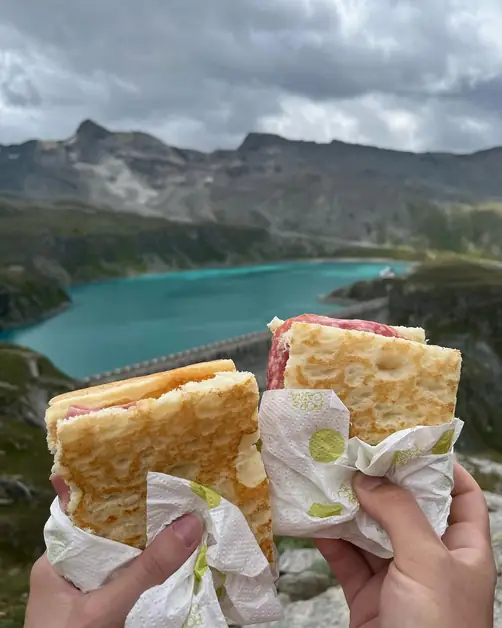
No, there are no mountain huts or restaurants near Lake Goillet. It is advisable to bring a packed lunch so that one can take a scenic break directly on the shores of the lake. A picnic in the mountains becomes an integral part of the hiking experience.
When is the best time to visit Lake Goillet? Seasons and ideal periods
The ideal time to visit Lake Goillet is in summer, between June and September, when the snow has melted and the trails are passable. In spring and autumn, it is necessary to check the weather conditions and the opening of the paths. The summer hike offers the best conditions for trekking and landscape photography.
Can the Matterhorn be admired from Lake Goillet? Panoramic views and reflections
Yes, the Matterhorn is reflected in the crystal-clear waters of Lake Goillet in a unique setting. This natural spectacle and the mountain's reflections are one of the main reasons why many tourists and photographers choose this panoramic hike. The reflection of the Matterhorn in the lake creates extraordinary photographic opportunities.
What are the characteristics of the Goillet dam? Engineering and history
The Goillet dam, built between 1939 and 1948, is a monumental engineering work. It made possible the creation of the artificial basin and still plays a fundamental role in the production of hydroelectric energy and the snowmaking of Cervinia's slopes. The architecture of the dam represents an example of 20th-century mountain engineering.
Can Lake Goillet be reached by ski lifts? Access and transport
The ski lifts of Cervinia take you up to Plan Maison and Plateau Rosà, but Lake Goillet is mainly reached on foot. This makes the trip more authentic and immersive in the alpine nature. The pedestrian access ensures a complete trekking experience.
Is it advisable to bring children to Lake Goillet? Family hikes
Yes, if they are used to walking in the mountains. The trail does not have dangerous sections, but it is uphill in the initial part. For families with small children, it is better to assess the level of endurance. The family hike can become an educational experience about alpine nature.
What type of clothing is recommended? Equipment and technical clothing
Hiking boots, layered technical clothing, and a windproof jacket are essential. Even in summer, temperatures at altitude can drop rapidly. Adequate mountain gear also includes a hat, sunglasses, and sun protection. Layered clothing allows for adaptation to the typical climatic variations of the mountains.
What makes Lake Goillet special compared to other alpine lakes? Uniqueness and distinctive characteristics
The panoramic position beneath the Matterhorn, its history linked to the historic dam, and the fact that it is less frequented compared to other tourist destinations make it an authentic and evocative destination. The alpine lake offers a perfect balance between natural beauty, history, and accessibility, making it ideal for sustainable tourism and photographic excursions.