Mont Rascias from Champorcher for skiing and snowboarding
Explore Mont Rascias, the ideal destination for skiing.
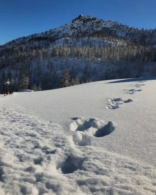
You arrive in Champorcher and, even before you start skiing, you realize one thing: the mountain here isn't just decoration; it's the main attraction. Mont Rascias (2,783 m) is a hike that makes you work -- about 1,200 meters of elevation -- but it does so smartly: forest, trails, open basins, and a rounded, comfortable, panoramic summit. If the day is clear, you'll find yourself looking around as if someone turned up the landscape's volume: Mont Avic peaks, distant profiles, and that feeling that the Aosta Valley can still be "grand" without being noisy.
It's a medium difficulty route, with an ascent that normally takes between 3 and 4 hours: long enough to be satisfying, regular enough not to feel like a gamble. The key, though, is to prepare well: simple logistics, the right pace, attention to the snow. And yes: the difference between an "okay" trip and a memorable one on Rascias often comes down to a half-hour detail.
Mont Rascias from Champorcher: What to Really Expect
Mont Rascias from Champorcher works because it's not monotonous. You start at Chardonney (1,425 m), near the lifts, and in the first minutes, you're still in the "orderly" world of the slopes. Then, gradually, the ascent moves to wider spaces: the environment changes, and you find yourself in a valley that seems higher and more open than you imagined from the parking lot.
This variety is its strength even when the snow isn't perfect. If you find hard snow in the morning in the forest or on beaten tracks, above you'll often have colder and more uniform snow. And if it's spring, the milder air makes the effort more manageable... as long as you don't underestimate the start time, because above 2,000 meters, the snow can change quickly.
If you want to understand the natural context you're moving in (and why this area has an "intact" charm), this guide on the Mont Avic Natural Park in the Aosta Valley is useful: it places Champorcher in a frame that makes the trip even more meaningful.
Getting to Chardonney: Roads, Parking, and Sensible Timing
By car, the classic access is exiting at Pont-Saint-Martin on the A5 Torino-Aosta and going up the valley through Hône, to the main town and then to Chardonney, where you'll find the lift parking lot. It's an easy ascent, but in winter, consider that the last stretch can be slower if it has snowed: nothing complicated, just don't treat it like a "city trip."
For official and updated information on access and how to reach the valley, this official tourist page is helpful: How to Reach Us - Visit Champorcher. (Visit Champorcher)
That said, practically speaking, a simple rule applies: in peak season, if you park after 9:30, you risk setting up your gear in the middle of parking lot traffic.
The best starting point remains the Chardonney parking lot: you arrive, park, prepare without stress, and start climbing immediately. If you want to avoid unnecessary detours (especially on weekends), also check out the best parking options for skiing in Champorcher: it's the same logic that saves you time even when you're in ski touring mode.
Ascent Route to Dondena: Key Steps
From the parking lot, the first stretch follows the return trail: it's often the most "physical" part because it tends to be steeper and more beaten. Here's a simple but useful tip: don't start too fast. A steady pace, with calm breathing, lets you conserve energy where there's no need to prove anything to anyone.
After the initial climb, the terrain opens into a wider, almost flat area: it's a perfect spot to drink and check your gear (lifts, gloves, glasses). Then you head towards Laris, and when the trail narrows, on the right, you'll find the "ski touring route" sign: from there, you enter the more interesting part, leading towards Dondena, alternating clear tracks and sections where it's best to keep a clean line.
When you reach the Rifugio Dondena (2,186 m) area, you've already covered a good chunk of elevation and, most importantly, you're in a high-altitude environment. Many take a long break here: I prefer a short and focused pause (5-8 minutes) because cooling down too much means starting again stiffly.
From Dondena to Mont Rascias Summit: Pace and Orientation
From the plateau above Dondena, the ascent changes again. You deviate and gain altitude with a long diagonal and some switchbacks: nothing extreme, but it's the stretch where the wind can be felt, and the snow can become more variable. If you encounter hard snow or icy sections, having crampons in your backpack isn't "optional": it's the detail that saves you from unnecessary balancing acts.
The summit of Mont Rascias is a rounded dome: it's not a "mean" peak, but it's a peak that gives you space. The view, on clear days, is wide and readable: it's one of those places where you naturally point out mountains to those with you, even if you don't know all their names.
The descent usually follows the ascent route. Wide slopes make turns fun and smooth, especially with fresh or well-packed snow. Just remember a small return to the Laris ski lift area (a short climb/connection): knowing this beforehand avoids end-of-day frustration when you thought you could just "go down".
To orient yourself well--especially if visibility drops and you want to avoid relying only on others' tracks--it's useful to know the logic of regional trail markers: this guide on trail numbering in Valle d'Aosta is practical support, even for those who think in terms of valleys and pastures in winter.
Safety and Equipment: What You Need and What to Check
For Mont Rascias, you need ski touring or splitboard gear with climbing setup (skins, crampons if necessary) and a complete rescue kit: beacon, shovel, and probe. This isn't an "expert" detail: it's the minimum standard for being in the mountains responsibly. Add spare gloves and an extra warm layer: if it's windy, even with sun, you can find yourself at 0°C or below, and the summit break becomes shorter than you'd like.
The best window is generally from December to April. In spring, days are longer, yes, but the snow changes faster: starting early is often the smartest choice, not the most heroic. For an official and updated danger check, here is the main regional reference: Avalanche Bulletin - Autonomous Region of Valle d'Aosta. (Avalanche Bulletin)
Read it carefully, looking at altitude, exposures, and the type of avalanche problem of the day, not just the number.
For maps, a solid base is the IGC 1:50,000 - Ivrea, Biella, and Lower Valle d'Aosta: useful for quickly reading basins, pastures, and elevation changes, especially if you like having a plan B (or if the track "disappears" under recent snowfall).
My Ascent: The Lesson Learned with Changing Snow
Once on Mont Rascias, I made the most common mistake: I took the start lightly. It was March, cold air at the parking lot, and the sun already strong on open parts. While putting on the skins, I heard that typical sound of hard snow under boots, almost dry. "Perfect," I thought. I started cheerfully on the initial stretch, which invites you to push because you're still close to the slopes and feel in control.
After about an hour and a half, entering the basin, I felt the snow change: the snow under the skins started to "stick," every step seemed to pull back. The sweat cooled as soon as I stopped, and I realized I had made two mistakes: pace and micro-break management. Since then, on Rascias, I do this: constant pace, very short breaks (drink and go), and a target time that keeps me "ahead" of the snow transformation. The result is simple: you arrive more clear-headed, and the descent becomes a reward, not a struggle.
Mistakes to Avoid on Mont Rascias
🚫 Starting late in spring
With sun and mild temperatures, the snow can become heavy in the central hours. Starting early often means climbing better and descending better.
🚫 Burning energy on the first steep section
The trip is long: if you overexert early, you'll pay for it above Dondena. Keep a pace you could maintain for 4 hours.
🚫 Skipping the beacon check before moving
A quick group check is enough: active transmission, batteries okay, shovel and probe present. Doing it "after" makes no sense.
🚫 Following others' tracks without reading exposure and wind
A track can be old or wrong for that day. If accumulations and slabs seem "strange," stop and think.
🚫 Underestimating the cold at altitude
At the summit, the wind shortens breaks. An extra warm layer weighs little but makes a difference.
If you're looking for a complete trip, Mont Rascias offers everything: real elevation gain, wide landscapes, a comfortable summit, and a descent that, on the right days, brings you back to the parking lot with that tired smile worth more than a thousand photos. Prepare well, start wisely, and choose the right day: that's when it becomes a "clean" experience.
Ready to fill the day (and maybe the weekend) without last-minute improvisation?
💰 Check ski pass prices at Champorcher
🗺️ Snowshoeing at Pian Coumarial: a perfect idea when you want to slow down
🌲 Pian Coumarial: the natural paradise in Valle d'Aosta
❄️ Champorcher: the ideal destination for a snow vacation