Cycling route Brusson between nature and landscapes
Explore the cycling route Brusson with breathtaking views and nature.
Where is the cycling route Brusson - Col de Joux - Col Tzecore - Brusson?
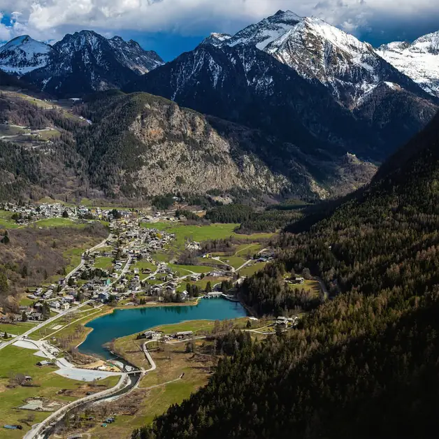
This fascinating ring itinerary is located in the heart of the Aosta Valley, between the Val d'Ayas and the central valley. The starting point is the town of Brusson, situated at an altitude of 1,338 meters, from where a road leads first to Col de Joux and then to Col Tzecore, two very scenic passes that allow you to enjoy spectacular views of the mountains and the towns of the valley.
How long and challenging is the cycling route?
The route covers about 45 kilometers with a total elevation gain of about 1,200 meters. It is a loop suitable for moderately trained cyclists, but can also be tackled by those using an e-bike. The climbs are never extreme, but some ramps require good endurance. The descents, on the other hand, are very pleasant and scenic, ideal for those who love to cycle immersed in nature.
How does the itinerary from Brusson to Col de Joux begin?
From the center of Brusson, you head towards Extrepiéraz and Vollon, following the road that climbs towards Col de Joux. The ascent is regular and well-paved, with gradients ranging from 6% to 8%. Along the route, you pass through larch and fir forests and enjoy wonderful glimpses of the Val d'Ayas. After about 8 kilometers of climbing, you reach Col de Joux, located at an altitude of 1,640 meters.
What can you admire from Col de Joux?
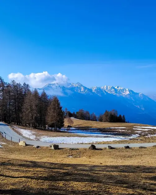
Col de Joux is one of the most beautiful viewpoints in the Aosta Valley. From here, you can admire the mountains of Val d'Ayas, the Monte Rosa range, and the peaks surrounding Saint-Vincent. The pass is surrounded by a dense coniferous forest and offers a cool climate even in summer. It is the ideal place for a short break, to refill your water bottle at the fountains, or simply to enjoy the view.
What happens after reaching Col de Joux?
From Col de Joux begins a smooth and scenic descent towards Saint-Vincent. The road is wide, with gentle curves and stretches immersed in greenery. During the descent, you encounter small villages and scenic points where it is worth stopping for a photo. After about 10 kilometers, you arrive near Saint-Vincent, famous for its thermal baths and mild climate.
How do you climb back from Saint-Vincent to Col Tzecore?
From the area of Saint-Vincent, you continue towards Emarèse, a small mountain municipality located at about 1,200 meters altitude. The climb is more challenging than the first part, with gradients exceeding 9% in some places. However, the road is well-paved and little trafficked, ideal for those seeking tranquility. After passing the capital of Emarèse, you continue until you reach Col Tzecore, at 1,620 meters.
What does Col Tzecore offer to cyclists and tourists?
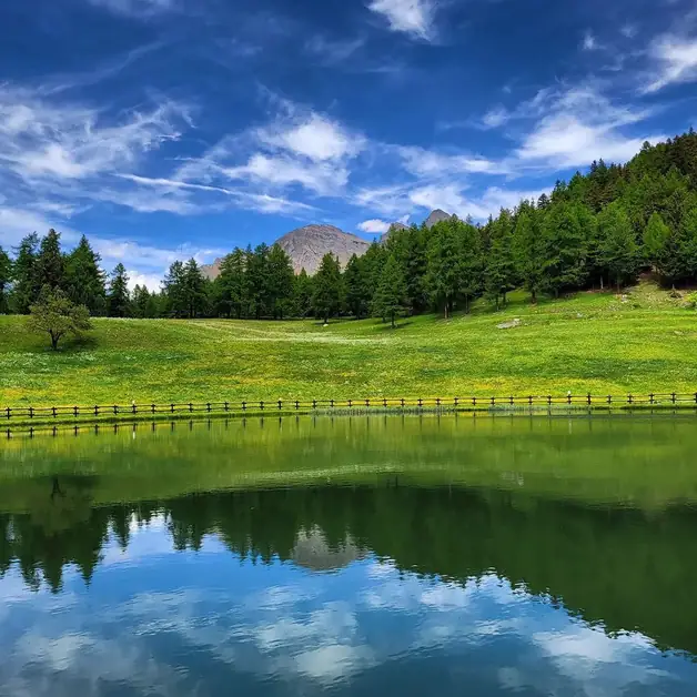
Col Tzecore is another magnificent viewpoint from which you dominate the central valley and can admire mountains such as Mont Avic and Mont Nery. At the top, there is a picnic area equipped with tables, fountains, and shaded areas, perfect for a refreshing break. The environment is peaceful and surrounded by forest, providing a pleasant sense of tranquility.
How is the descent from Col Tzecore to Challand-Saint-Anselme?
From Col Tzecore, a steep and winding descent begins towards Challand-Saint-Anselme. The gradient can reach 10%, so it is advisable to pay attention to the brakes. However, the road offers spectacular views of the valley and the Evançon stream. During the descent, you pass through small villages and encounter numerous water points, ideal for refreshing on hot days.
How do you return to Brusson from Challand-Saint-Anselme?
Upon reaching Challand-Saint-Anselme, you begin a gentle ascent back to Brusson along the regional road of the Val d'Ayas. The gradient is moderate and the ride pleasant, with the view gradually opening up to Lake Brusson. Arriving in the town perfectly completes the loop, providing a great sense of satisfaction.
What views can you admire along the route?
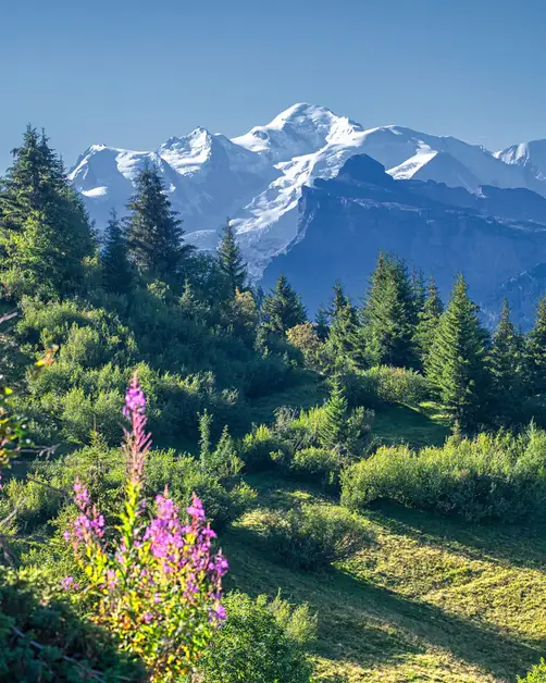
Throughout the itinerary, you can enjoy exceptional views of the Aosta Valley, the mountains of Val d'Ayas, and the Monte Rosa range. On the clearest days, you can also clearly distinguish the peaks of Gran Paradiso and Mont Avic. Every curve offers new glimpses, among forests, pastures, and small mountain villages.
What is the best time to do the cycling tour Brusson - Col de Joux - Col Tzecore - Brusson?
The ideal period is from June to September, when the roads are free of snow and the weather is mild. In spring and autumn, temperatures are cooler, but the colors of the forests make the landscape even more fascinating. In summer, however, the altitude ensures a pleasant climate even on the hottest days.
Is the route also suitable for e-bikes?
Yes, the itinerary is perfect for those using an electric bicycle. The regular climbs and paved roads make the route ideal for an e-bike excursion. Many cyclists choose this solution to enjoy the views without excessive effort, while still being able to complete the entire loop independently.
Why choose this route among all those in the Aosta Valley?
The cycling tour Brusson - Col de Joux - Col Tzecore - Brusson is one of the most complete and scenic tours in the region. It offers a perfect combination of nature, sport, and discovery of the territory. In just one day, you cross two spectacular passes, visit authentic towns, and cycle through forests and breathtaking landscapes. An experience that combines a passion for cycling with the beauty of the Aosta Valley mountains.